
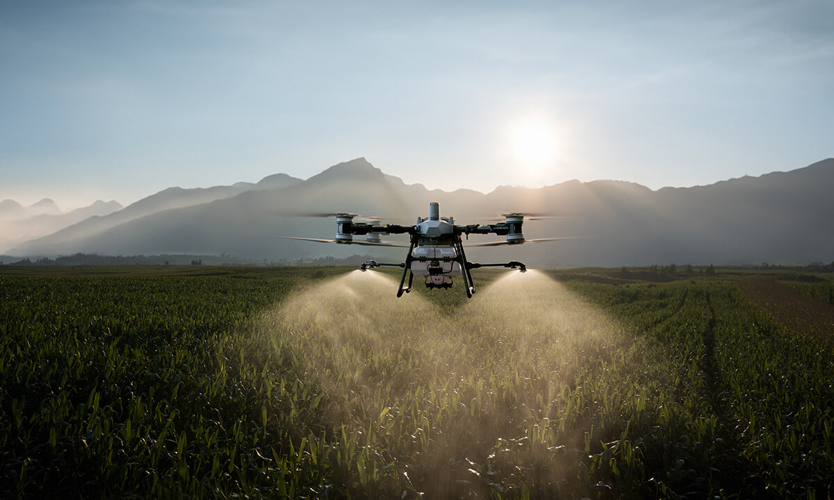
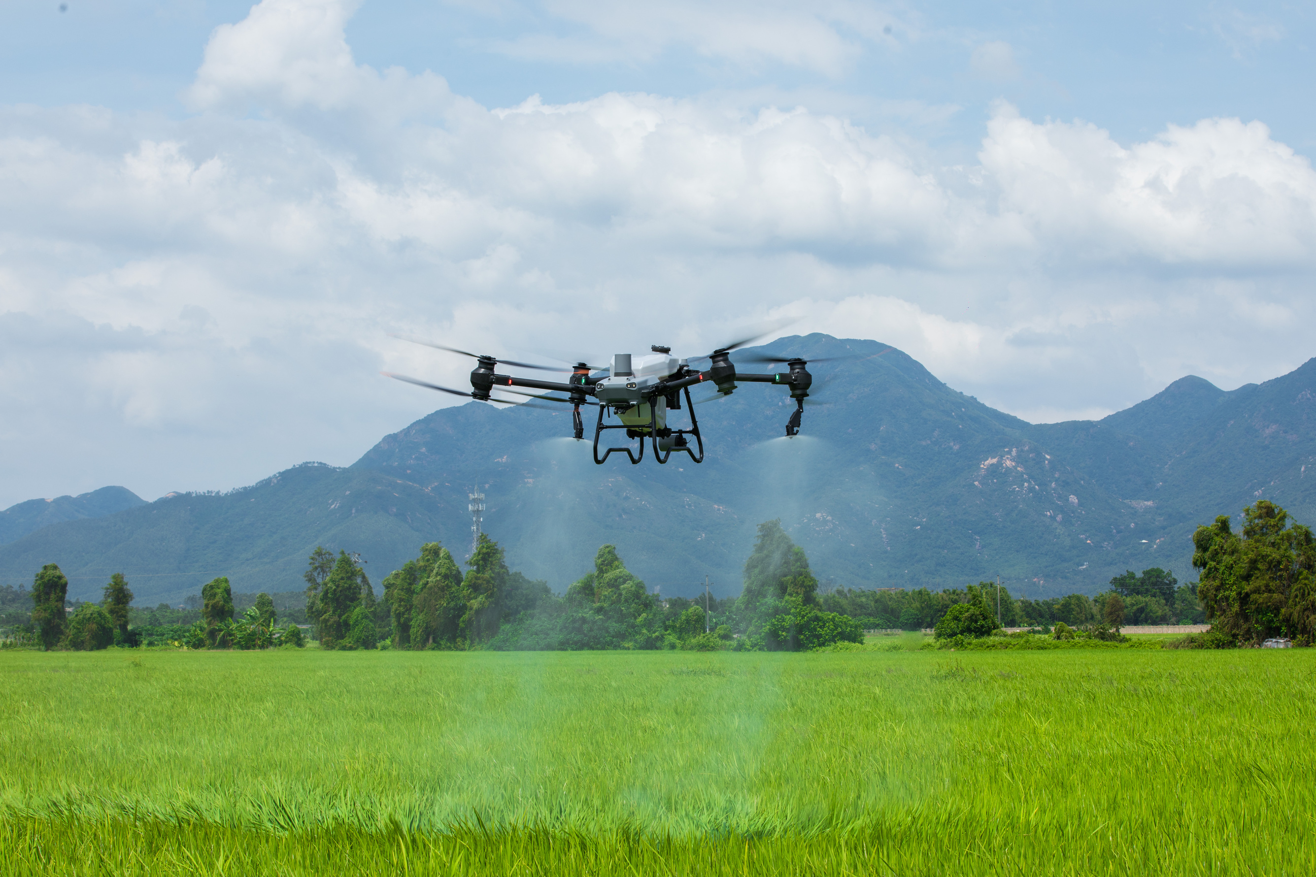
Adjustable Microns: The DJI T100 and T50 Drone allows the user to choose how large the droplet size is of the spray, ranging from 50 - 500 microns.
Terrain Following: The DJI T100 and T50 can detect and fly over objects and keep a steady flight and spray path even over rolling hills or slopes up to angles of 50º.
Variable Rate Spraying: When paired with the Mavic 3 Multispectral, crop maps can be uploaded to the DJI T100 and T50 to spray according to the drop data collected, making efficient use of time and chemical.
Complete Coverage: Because of the downwash from the rotors, the chemical thoroughly covers the crop with ease.
Fast Charge: Batteries for the DJI T50 charge in just 9 minutes coupled with a 15 kw generator.
Saves Money: 2 - 5% of crop is crushed by tire tracks through soil compaction, much less diesel consumption diesel consumption compared to traditional methods. Trips to refuel are also reduced, saving time.
Reduced Wear and Tear: Reduces wear and tear on expensive machinery through regular or intermittent use of the Agras T100 and T50.
Flooded Fields: Sometimes fields flood, creating wet soil conditions. With the DJI Agras T100 and T50 you do not need to worry about soil compaction, getting stuck, or calling for an aerial sprayer.
Example:
Farmers use the Agras T100 drone or T50 drone to spray large orchards and agricultural lands with fertilizers and pesticides, relying on its Orchard Mode and smart mapping to avoid obstacles and maintain consistent spraying height on hilly terrain. This reduces chemical waste and crop damage while improving yield.
Crop Health Monitoring: Early disease detection of crops, and the current health of the crops are just one of the ways that the multispectral cameras assist farming operations.
Field Mapping: The DJI Mavic 3 Multispectral can collect data from agricultural lands / forests, and with this data, it can be turned into a map that can be uploaded to the T100 drone or T50 drone for efficient spraying use.
Long Flight Time: 43 minutes of flight time or 490 acres per flight.
Powerful RTK: RTK module for high-accuracy mapping and precise field data.
Example: A vineyard owner uses the Mavic 3 Multispectral to detect early pest infestations and nutrient issues, enabling timely treatments that prevent crop loss. Similarly, grain farmers use it to tailor fertilization strategies based on detailed crop health maps, boosting yields.
Leverage Date: Prescription maps from multispectral data guide spraying and fertilization
Automated Efficiency: Automated flight routes improve efficiency and consistency
Real-Time Data: Real-time field condition insights enable proactive interventions
Sustainable: Supports sustainable farming with reduced chemical use and optimized yields
Example:
Farmers perform quick aerial patrols with the Mavic 3 Multispectral to identify stressed areas, then deploy the Agras T100/T50 to apply targeted treatments based on prescription maps. This coordinated approach saves time, reduces costs, and enhances overall farm productivity.
The DJI Agras T100 is the largest farming drone available, with a 100kg payload, 100L spray tank, and 150L spreader for seeds and fertilizers. It sprays up to 40L per minute and can handle various lifting tasks. Paired with the Mavic 3 Multispectral drone for detailed crop health mapping, these drones offer simple-to-use, advanced data collection and land mapping with features like Advanced LiDAR Radar for topographical surveys.
The DJI Agras T50 is a powerful farming drone with a large payload, efficient spray tank, and spreader for seeds and fertilizers. It offers high-volume spraying, advanced automation, and, when used with the Mavic 3 Multispectral drone, delivers simple, effective crop health mapping and land surveys—even for complex fields.
The D-RTK 3 Multifunctional Station can serve as a base station to provide centimeter-level positioning for multiple drones simultaneously or extend the operational range of drones in relay station mode. Additionally, the new Rover Station Mode, combined with the DJI Enterprise app and DJI Terra, provides a comprehensive solution for high-precision aerial surveying applications, ensuring a secure and accurate operation.
View RTK EquipmentThe D-RTK 2 is a rugged, portable GNSS base station that delivers centimeter-level positioning accuracy for DJI Agriculture Drones, supporting all major satellite systems and enabling multi-drone operations for precise mapping, surveying, and inspection.
View RTK Equipment


